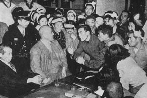
The Uchinada Battle
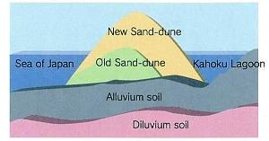
Remains of earthenware pots found in the sand dunes
of Uchinada tell stories of humans living in the area
since the Jomon period.Settling down at the area has
continued since the middle ages, but the name
"Uchinada" did not appear upon the stage of Japanese
history until 1952, with the occurrence of the United
States Military Firing Ground Condemnation Conflict.
The condemnation and opposition activities associated
with this conflict were referred to as
"The Uchinada Battle," which continued until the
complete withdrawal of the United States occupation
in 1957. Stagnation in the fishing industry, a major
source of life support for the townspeople, led to the
development of an agricultural promotion policy and
the execution of the Kahoku Lagoon Land Reclamation
Project. Uchinada was officially established as a town
in 1962, and with the ensuing changes to its industrial
structure, the town has continued to be vitalized by
its domestic industrial fiber industry, and the development
of residential areas has continued to rise.
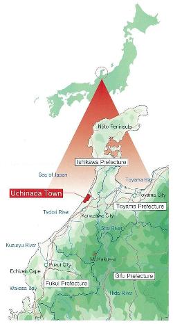
 Located in the central part of Ishikawa prefecture,
111111.jpg)
